


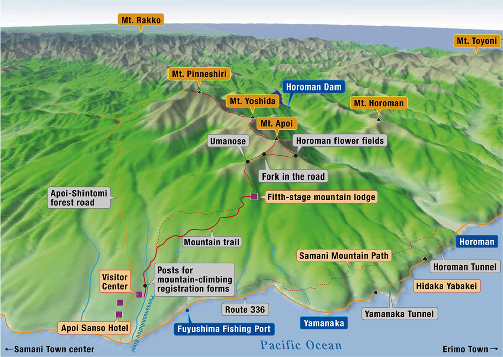
Mountain climbing: Mt. Apoi Route
Mt. Apoi Area
- 5-hour route
- Geosite map Download PDF file
This mountaineering route for people of all ages is ideal for climbers hoping to see alpine flowers, peridotite mountains and panoramic views of the Pacific Ocean.
Tourist information center (Former Samani station)
Drop in at the tourist information center in the station building.
Tourist information center
| Open | 8:30 - 16:30 (Weekdays in Nov. - Mar. ;10:00 - 16:00) |
|---|---|
| Closed | Apr. - Oct. ;Open daily Nov. - Mar. ;Wednesday and Thursday Year-end and New Year holidays |
| Tel. | +81-146-36-2551 |

Approx. 10 min. by car
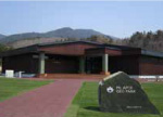
Mt. Apoi Geopark Visitor Center
The visitor center provides information on Mt. Apoi and other aspects of Samani's geology, natural environment, history and culture. (Time required: 30 minutes)
Mt. Apoi Geopark Visitor Center
| Open | April - November |
|---|---|
| Closed | Open daily |
| Hours | 9:00 - 17:00 |
| Admission | Free |
| Tel. | +81-146-36-3601 |
Approx. 5 min.
Trailhead
For safety purposes, please write your name in the forest entry register located outside along the hiking path.
Approx. 1 hr. 15 min.
Fifth-stage mountain lodge B1Ecological
This area marks the limit of forest presence on Mt. Apoi. The trail's steepest slope continues from here to Umanose; climbers should drink plenty of water and rest well before resuming their ascent.
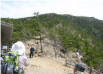
Approx. 40 min.
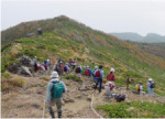
Umanose B5Geological
The Umanose mountain ridge area affords views of the Pacific Ocean to the south and ridges of the distant Hidaka Mountains to the north. Alpine flowers bloom freely along the trail from here to the summit.
Approx. 15 min.
Fork
Take the left fork to get to the summit. The right fork leads to the Horoman flower fields.
- Approx. 30 min.
- Approx. 30 min.
The previous horoman flower fields B7Ecological
The Hidakaso (Callianthemum miyabeanum) flowers that used to thrive in these fields are today seriously depleted due to illegal digging and the growth of dwarf stone pines.
Approx. 25 min.
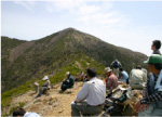
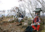
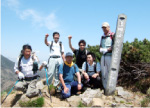
Mt. Apoi summit B6Ecological
The summit is surrounded by Erman's birch trees, meaning that views are limited. It is crowded with climbers eating lunch around noon.
- Approx. 40 min.
- Approx. 50 min.
- Approx. 20 min.
- Approx. 30 min.
Mt. Yoshida B9Geological
Stronger climbers may wish to negotiate the path to Mt. Yoshida, which takes about an hour. The ridgeline area on the way is characterized by rugged peridotite tracts and is a rich habitat for alpine flowers.
Descent from the mountain Approx. 2 hr.
Mt. Apoi Geopark Visitor Center
Approx. 10 min. by car
Ttourist information center
●A Hokkaido Government ordinance restricts access to certain areas of Mt. Apoi to protect threatened animal and plant species. In these areas, entry into zones other than trails without prior authorization is prohibited.