
Blog
2021.07.19
Learning about sand and cleaning up Cape Enrumu
We've been experiencing a hotter summer than usual here in Samani.
On Sunday, July 18th, we held an event to clean up the beach around Cape Enrumu and to learn more about the area.
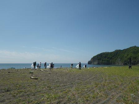
We had around 50 volunteers made up of Hidaka Credit Union staff, firefighters, Mt. Apoi Geopark guides, and townspeople.
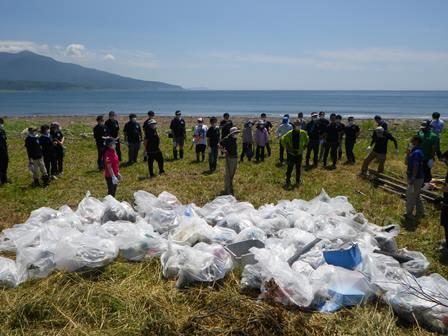
Due to the natural harbor created by the cape there was a quite a bit of trash and drift wood that washed ashore. The volunteers worked hard for 2 hours picking up cans, plastic bottles, plastic containers and more. We filled 50 120-liter bags and 30 45-liter bags. It was a lot, but we still were not able to pick up everything.
Did you know that sand originates from the mountains and that the geological composition of the mountains can change the color of the sand? The sand around Samani tends to be darker in color and one reason for that is a higher iron sand content. We tested this idea by using magnets to see how much iron was in the surrounding sand.
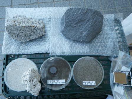
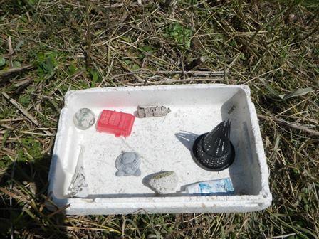
We found several unusual objects that drifted ashore such as a birch buoy that came from abroad, pipes and feeders from eel fishing, and even pumice.
Here are some flowers that bloom along the coastline.
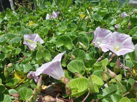
Seashore False Bindweed, Hamahirugao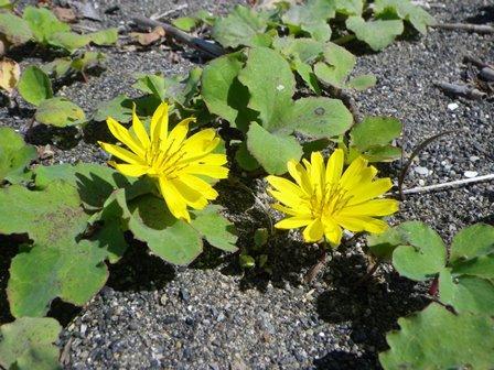
Hamanigana
It was a hot day, but the coastline is a lot cleaner now.
2021.06.11
First Online Pre-climb Presentation
Prior to the Samani Elementary School climbing Mt. Apoi this year, we held an informative presentation for the students. Every year the geopark sends a lecturer to the school, however, due to COVID-19 we held the first online lecture.
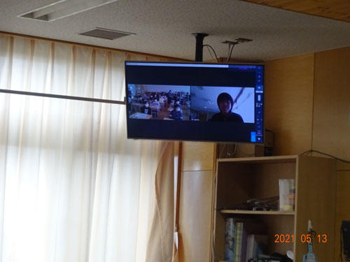
A look inside the classroom.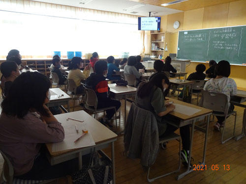
The students watched the presentation on a monitor in their classroom.
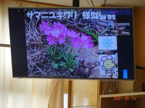
The presentation included information on the flowers, insects, rocks, and important aspects of Mt. Apoi.
From the lecturer's side of the monitor we could hear the student's energetic voices, see them nodding their heads, and taking notes. The presentations were held on different dates for each participating grade level: 6th grade on May 13th, 5th grade on May 13th, and 4th grade on May 19th.
This was the first time this kind of online exchange was implemented in a school in Mt. Apoi Geopark. Thanks to the elementary school faculty who facilitated communication among the students, the presentations were a success. Afterwards, we did realize that it might be best to narrow down the content since it does take more time than an in-person presentation.
2021.03.16
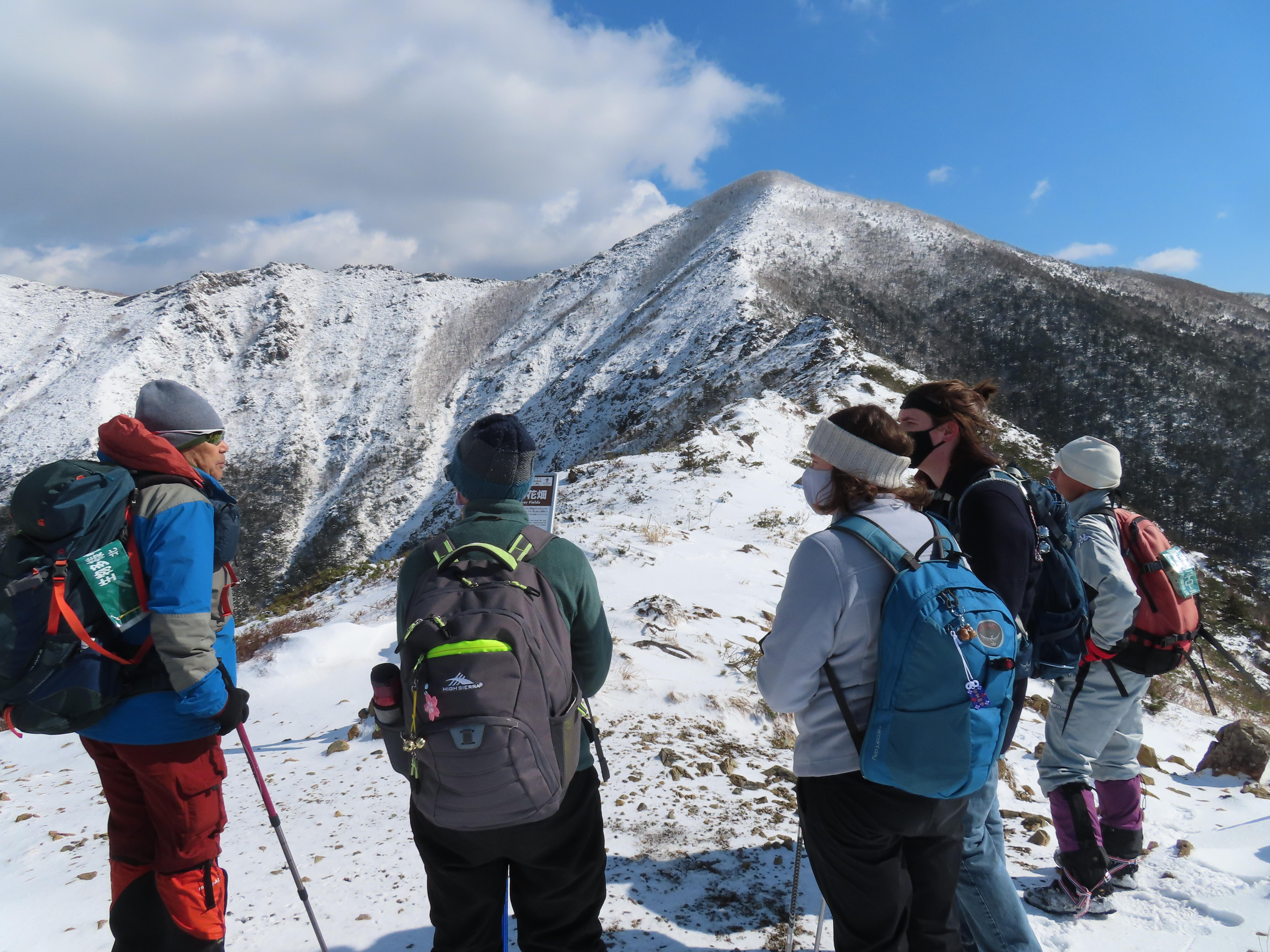
Mt. Apoi Winter Hike Monitoring Tour
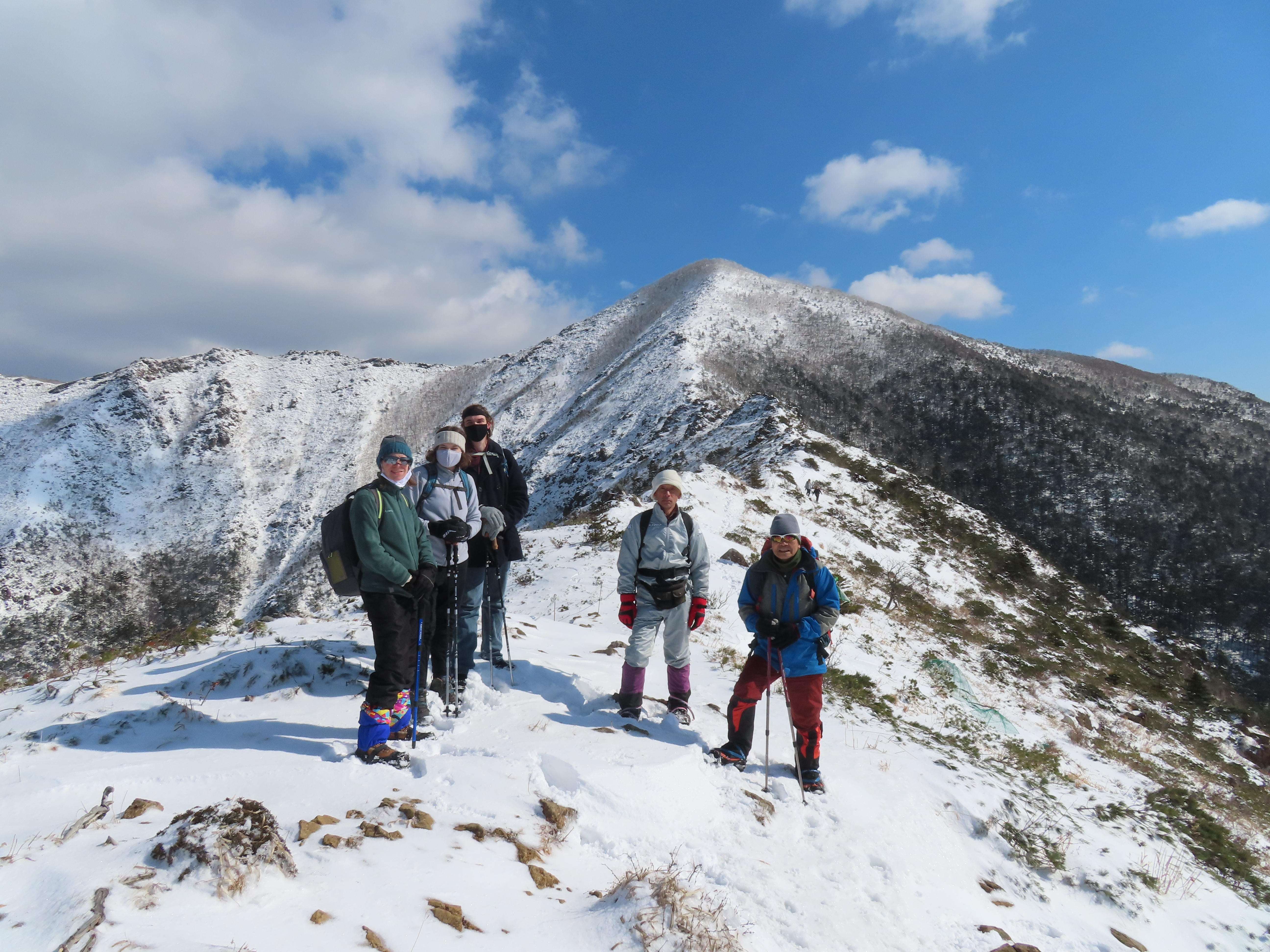
Towards the end of February, we held a guided winter hike up Mt. Apoi for foreign visitors. This time we had two participants, two guides, one interpreter, and one geopark staff. Since our participants had never attempted a winter hike, before heading towards the trailhead they were each given a set of spikes to put on the bottom of their shoes. The hiking trail is icy this time of year and this would ensure everyone has the traction needed to safely climb up the mountain. The guides cautioned everyone to keep space between their feet so you don't catch the spikes on your own leg.
As we walked towards the hiking trail our guide started explaining what kind of forest we would be walking through. The woods on the lower half of Mt. Apoi are a mix of coniferous and broad-leafed trees. He continued to point out some of the different pine trees that we could see. A sudden "rata-tat-tat" from a black-woodpecker brought our heads around and our guides were able to spot it high up in the trees. 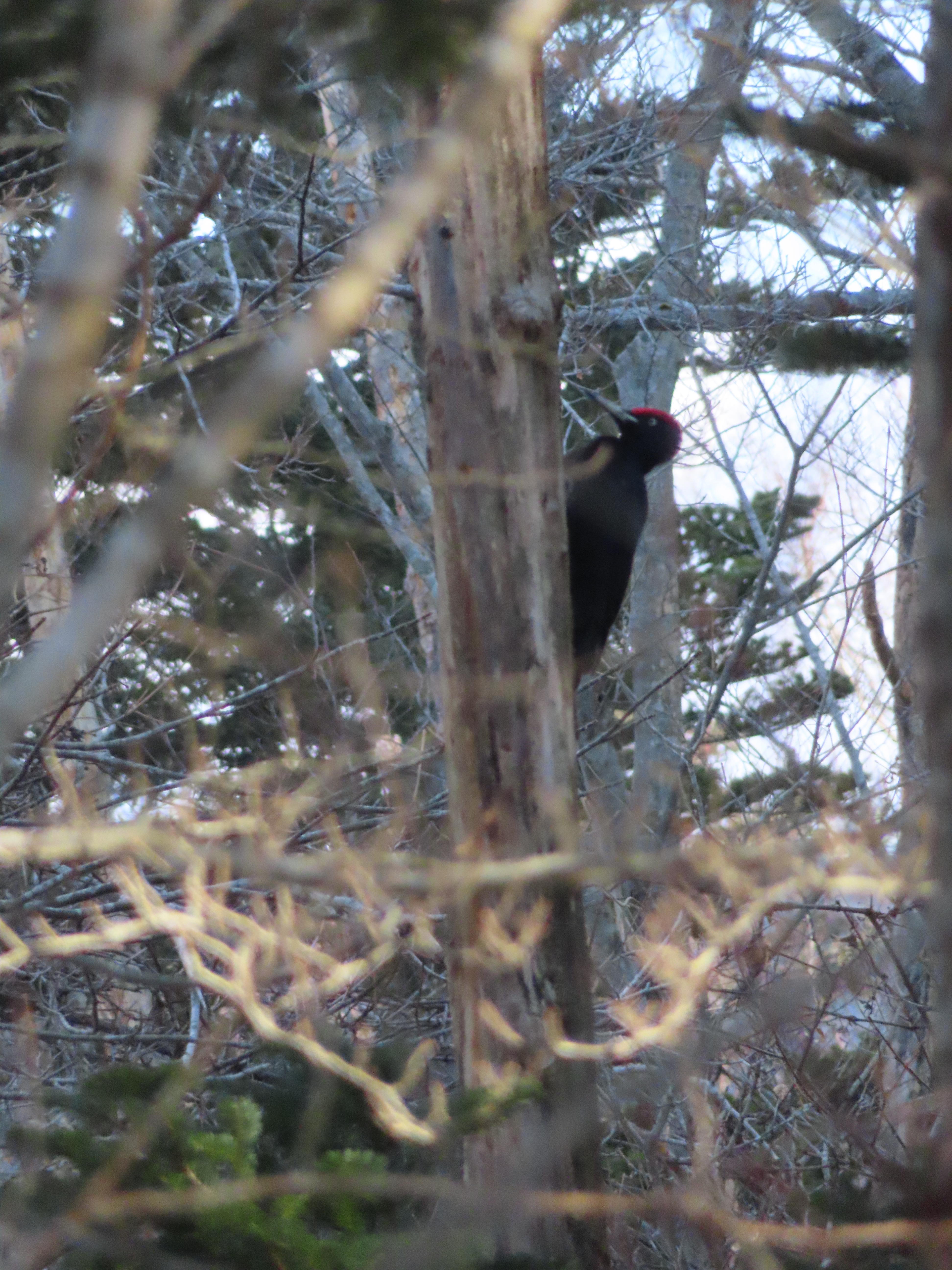
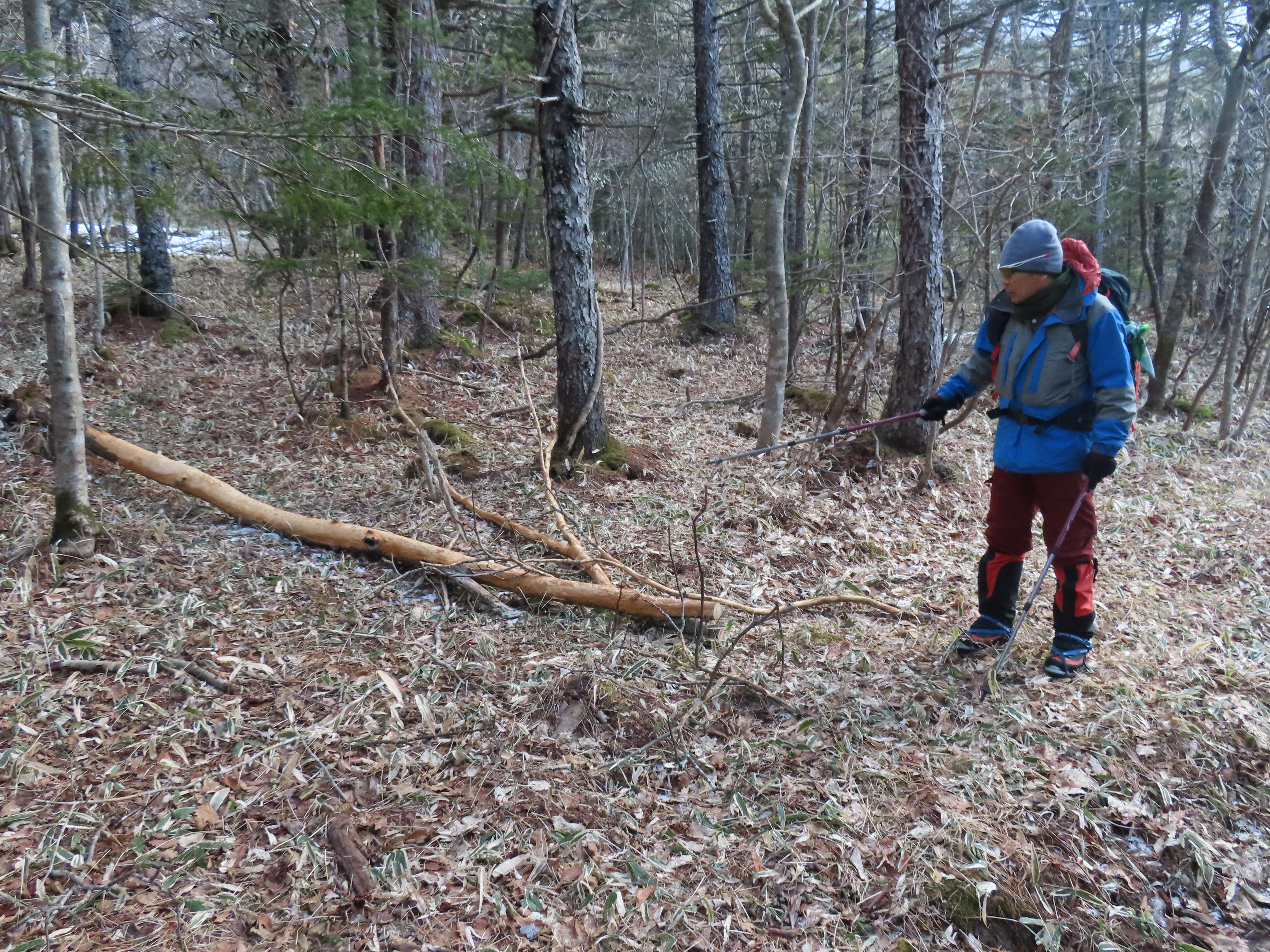
The hiking trail was completely covered in ice! The ice was so thick and even somewhat clear that at times it felt like we were climbing up a frozen waterfall. The trees prevented the strong wind from getting to us and our bodies quickly warmed up during the brisk hike to the 5th station. Along the way our guides pointed out old holes that were dug by bears, and markings on a tree that were from a deer's antlers. We even came across a fallen tree where the bark had been completely stripped by deer. 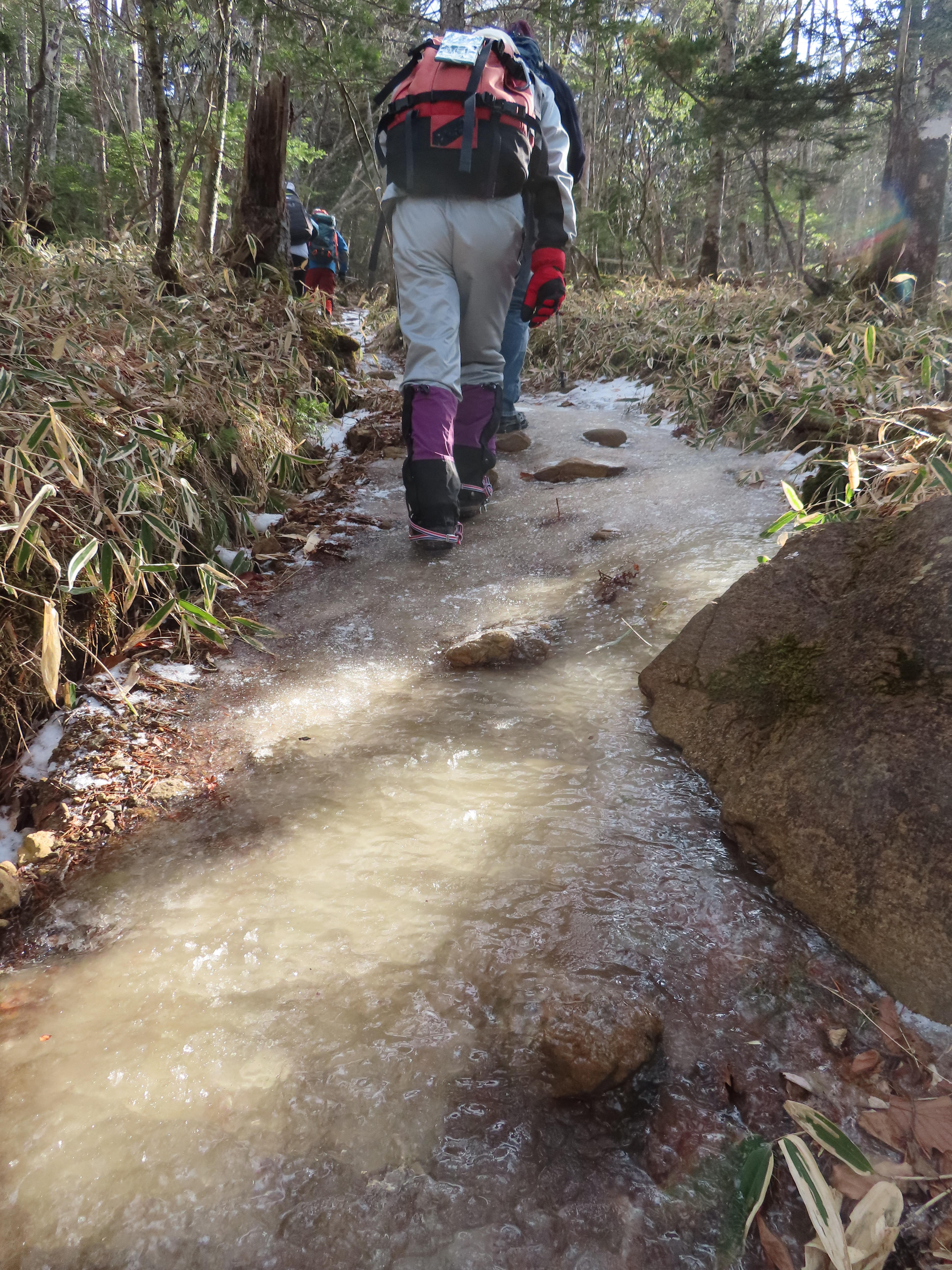
About ⅔ of the way to the 5th station our guide pointed out a marked difference in the landscape. From here the area was visibly marked by large peridotite rock outcroppings that suddenly appeared along the sides of the trail.
Shortly after that, we made it to the 5th station mountain hut. Here we took a long rest before heading further up the mountain. Leaving the 5th station also meant we left the tree line behind and the wind soon picked up even though it was a beautifully sunny day. As we climbed higher the views of Samani and the Pacific Ocean opened up before our eyes. The stark contrast of the snowy mountain and the shining blue ocean was breathtaking. As we neared the 6th station our guide began pointing out the Siberian dwarf pine trees and a rare hybrid Hakkoda pine. Even though the trail was buried in the snow there were still enough outcroppings of rock to show some of the different types of peridotite rock.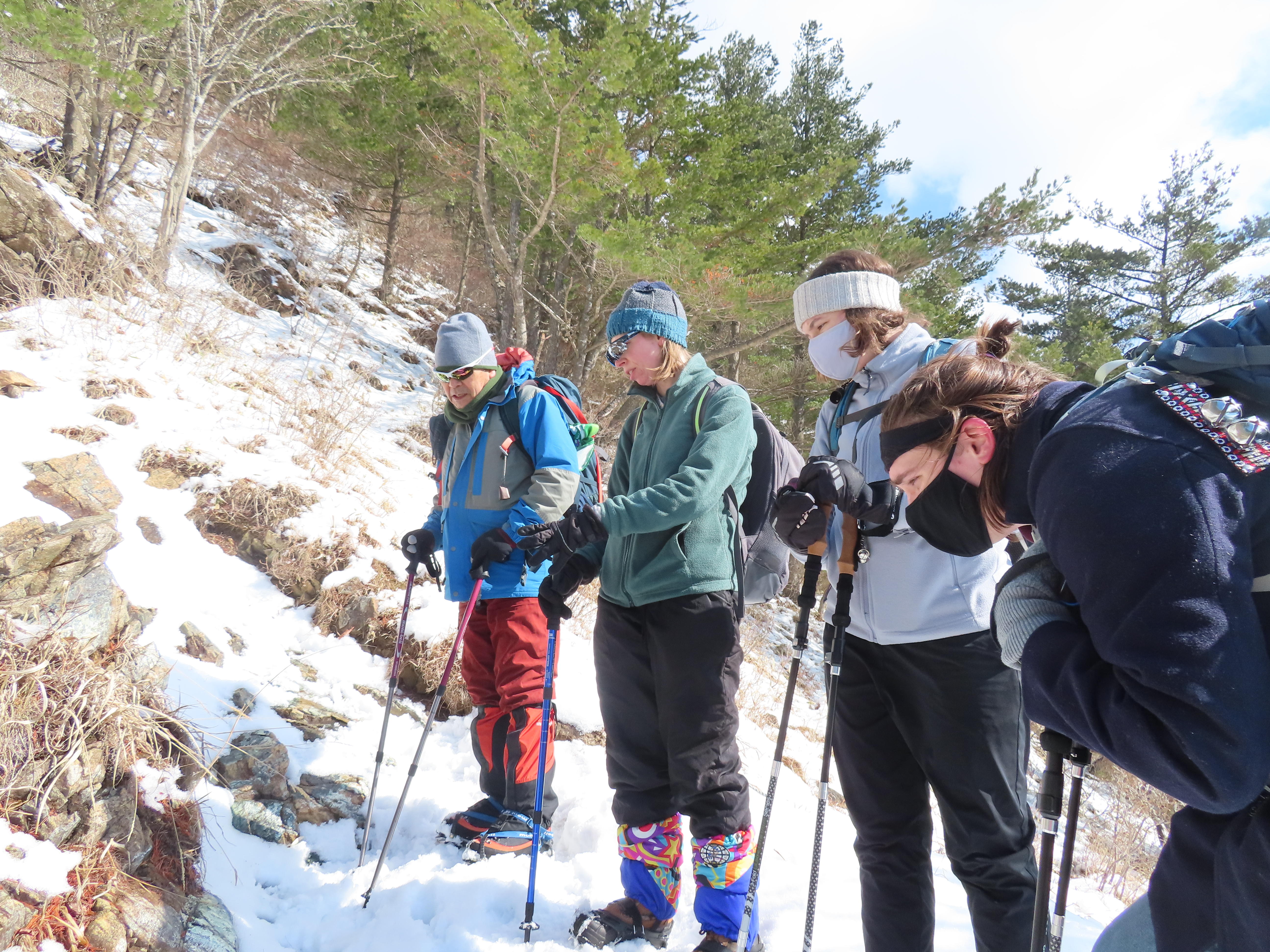 We also found a few small snow rollers along the path, a rare phenomenon where snowballs form naturally as chunks of snow are blown down a hill.
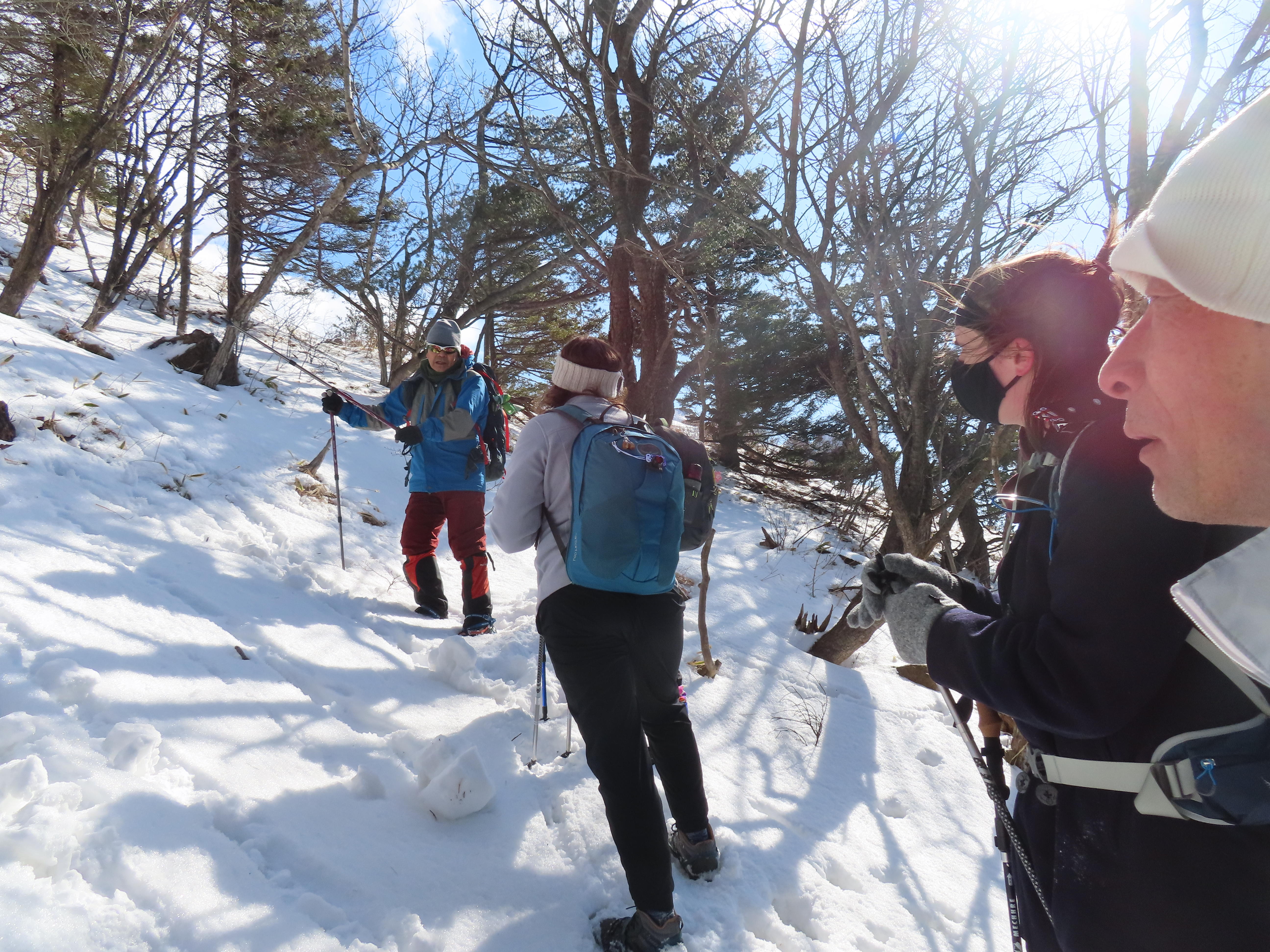
At last, we made it to our goal, the Horse's Back, just past the 7th station. From here we had a wonderful view of the Samani valley, the Hidaka Mountains, and the peak of Mt. Apoi. Our guides explained how the mountains were formed and how the unique uplifting of the land created the mysterious Apoi Mountainmass. The wind was getting steadily stronger so we decided to head back down to the 5th station mountain hut to have lunch. 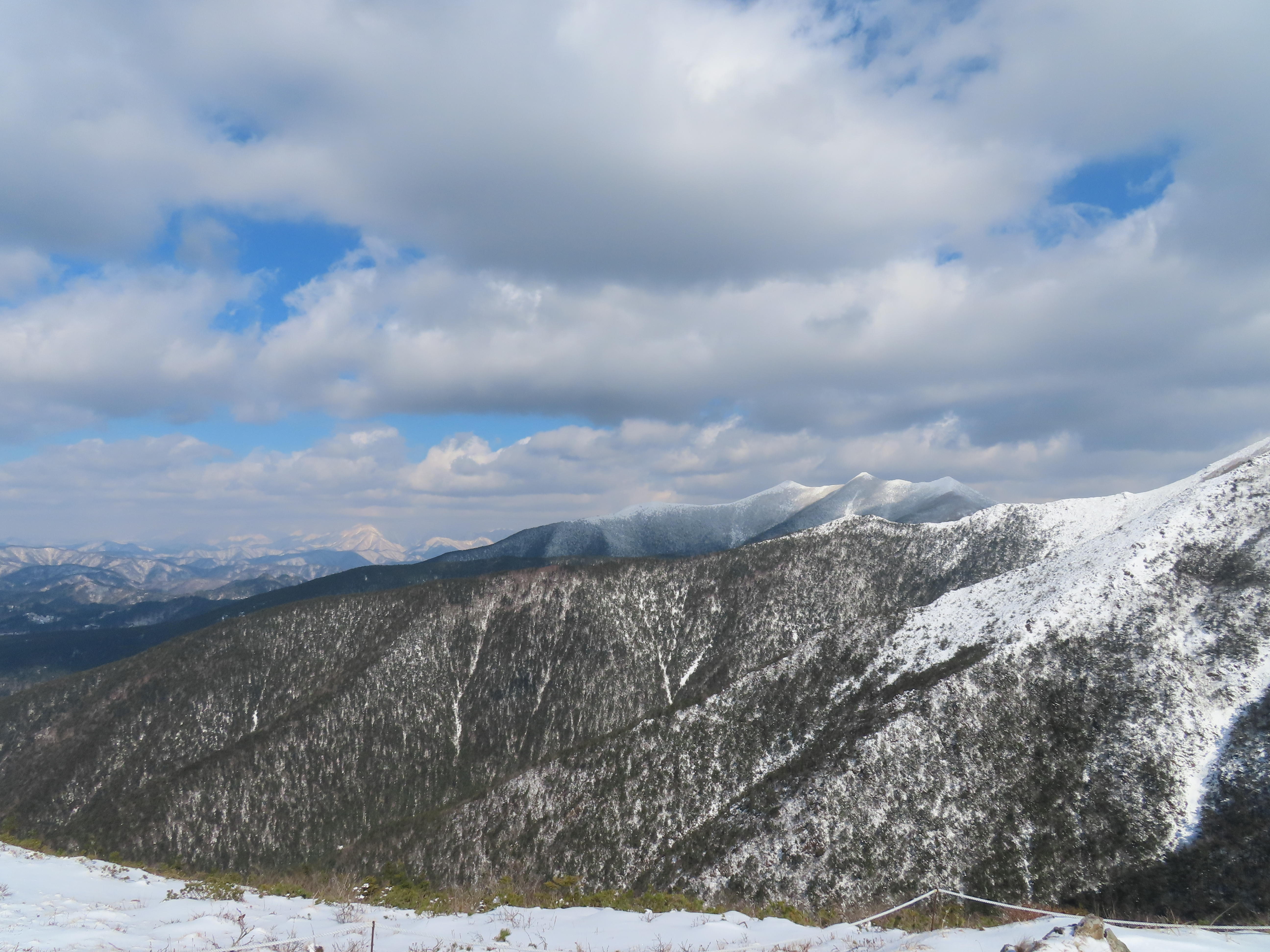
After the lunch break, we headed back down through the forest. We stopped once at the 4th rest spot and one of our guides was able to find a sleepy Japanese Crawfish (endangered species) that inhabits the mountain stream. As we came close to the final descent, we spotted a herd of Ezo deer in a small clearing. At first there were only two deer standing a ways away, then three, then five! It was a lovely way to end the hike. 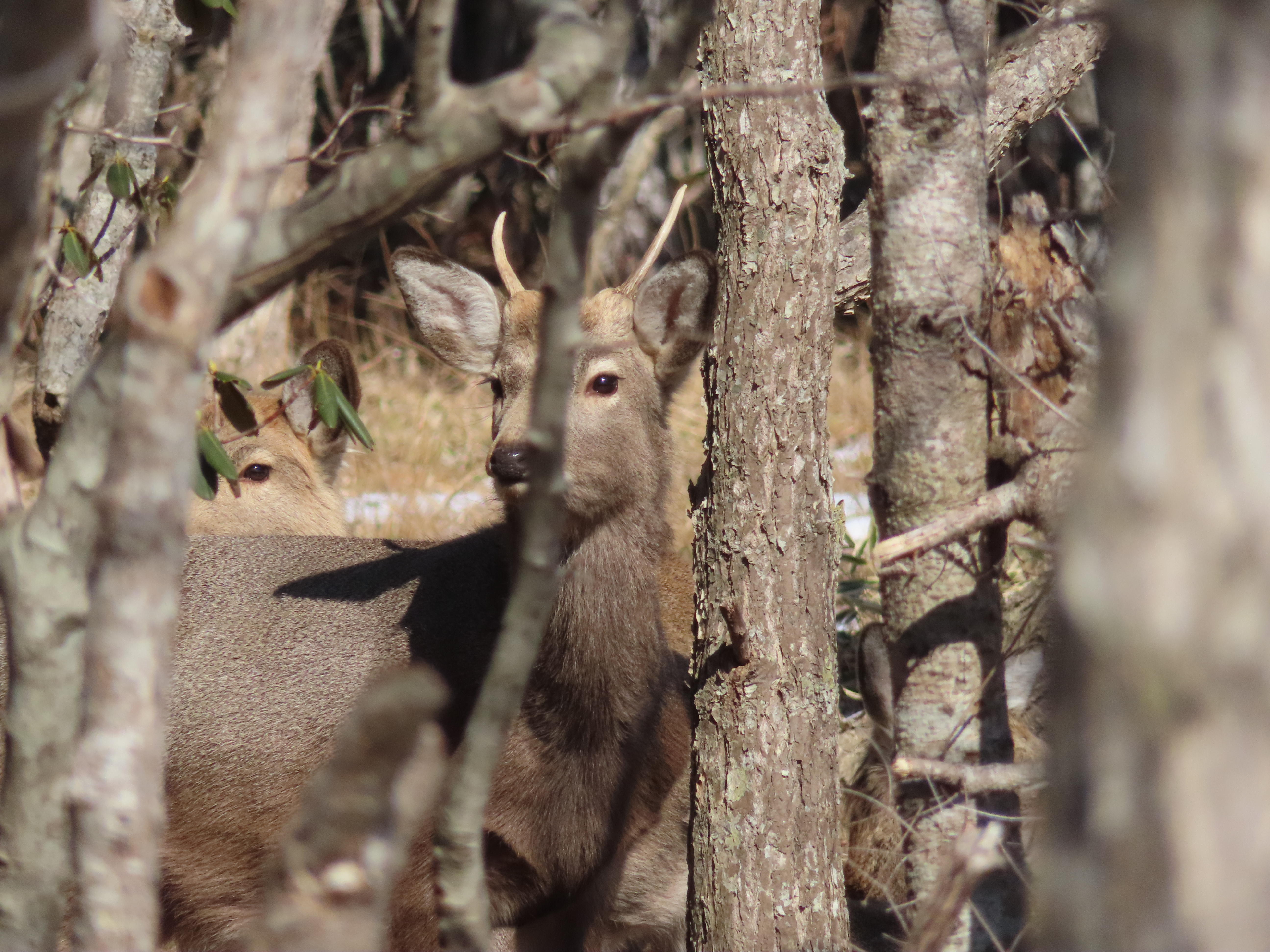 (D)
(D)
2020.10.29
Samani Mountain Path Monitoring Tour
Mid-October we held a third guided tour for foreign visitors. Compared to the first two guided tours where we visited each site by car, for this tour we decided to hike the historic Samani Mountain Path. This time we had four participants plus one guide and one interpreter.
We met the participants at the Horomon Community Center at nine in the morning. Before heading to the trail head, we first visited the Wasuke Jizo enshrined nearby. We learned about how Wasuke was important in assisting the construction of the Samani Mountain Path, and about his famous grandson, Hakodate Daikei who was a pioneer in Japanese horseracing. Next, as we walked towards the east entrance our guide pointed out Nenbutsu-Zaka. "Zaka" is Japanese for "hill," but it was anything but a hill. This steep cliff used to be one of the few ways a traveler could access the wooded area above the sea cliffs to pass through the area. It is dangerous to climb so travelers would chant "nenbutsu," Buddhist mantras, for safe passage, hence the name Nenbutsu-Zaka.

We reached the east entrance and began our hike. Not long afterwards we found the first porcelain electrical insulator lying on the ground. The Samani Mountain Path was also used as a maintenance path when the first telegraph lines were installed. You can find the shards of these porcelain electrical insulators laying around, as well as the utility poles, all along the trail. Some have company logos on them, and the participants were encouraged to see how many different logos they could find.
 "Yama Etsu" is the logo for Yama Etsu Denki Seito (1886~), an electrical company in Seto City, Aichi prefecture.
As we ventured further into the forest there was a section clear of trees. Our guide stopped and asked if the participants knew why this clearing was here. A few offered up some guesses, but none were correct. Apparently, before the mountain path was constructed the people who settled here used to farm here at the top of the cliffs. Can you imagine having to carry farming equipment up and down Nenbutsu-Zaka??
Continuing down the trail we came to Luranbetsu Stream and the lowest elevation along the Samani Mountain Path. Ropes have been installed to help hikers cross the stream and climb up the other side. It was tricky but we all made it safely to the other side.


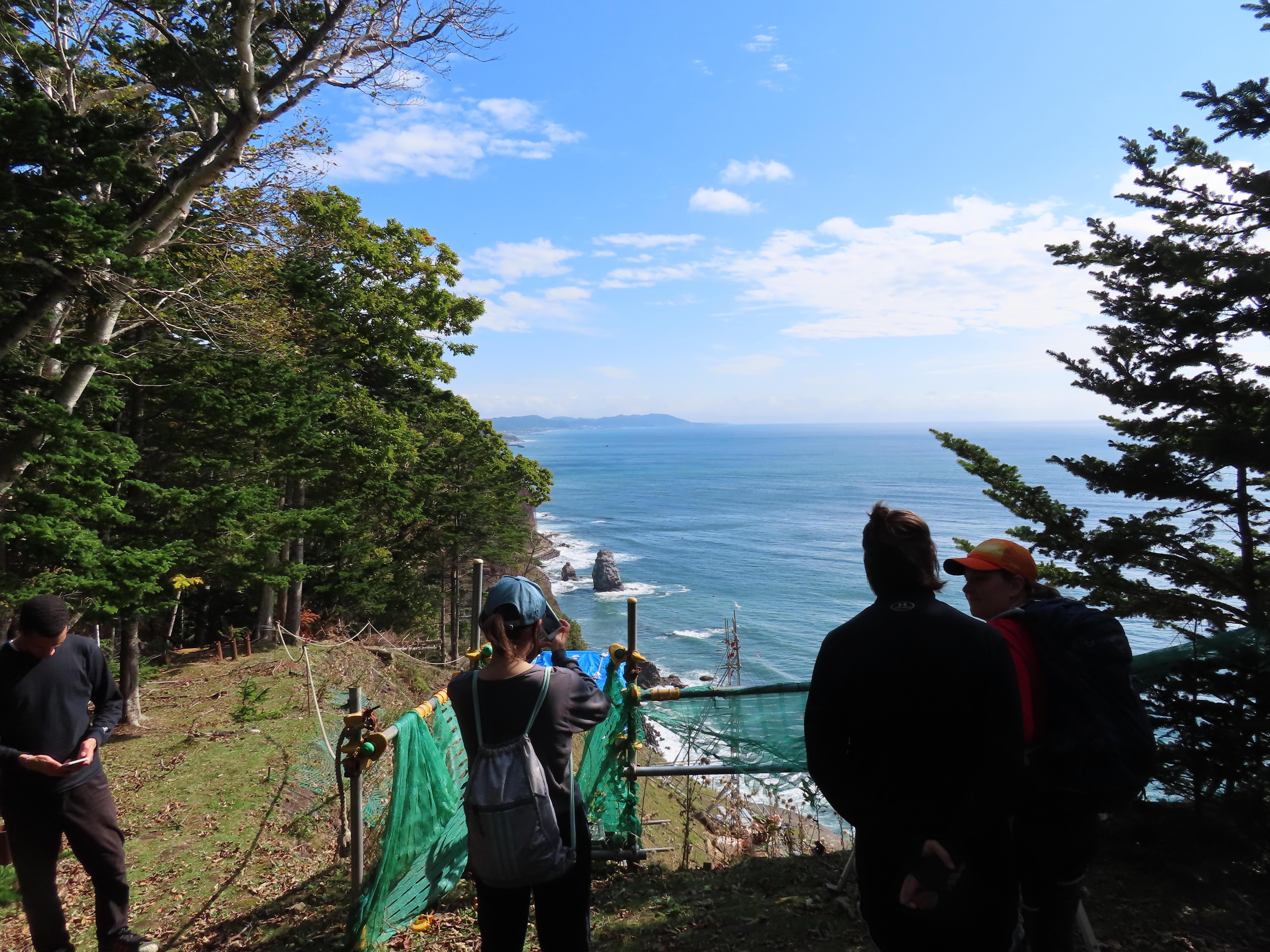
Shortly after the stream there is a small fork in the path, and if you turn right there is a viewpoint to see the Hidaka Yabakei. We had a lovely view of the cliffside and the beautiful blue ocean.
Another 30-60 minutes later we arrived at the old Harada Inn site. Here we stopped to take a rest and eat lunch. After everyone had eaten the guide told us about the Harada Inn and the archeological excavation that was conducted a few years ago. Even now you can occasionally find old shards of teacups and other pottery laying around on the ground.
It's about an hour hike from the Harada Inn to the Kotoni entrance. Along the way we came across a few more streams, such as the Komamonai and Ohonai Streams. These places were originally named by the indigenous Ainu. Komamonai means "a place of dry leaves," and Ohonai means "deep stream."
Towards the end of the trail our guide stopped to show us claw marks on a tree. The marks went all the way to the top of the tree. This shows that a bear most likely climbed up to the top to reach the fruit or nuts. "But don't worry," said our guide, "these claw marks are old."
 After 4.5 hours of hiking we finally made it to the Kotoni entrance. The Samani Mountain Path is a mysterious hike that allows you to step into the past and experience what it was like to travel through the area before modern roads.
2020.08.31
Horoman Gorge Monitoring Tour
We recently held the second guided monitoring tour for foreign visitors. The purpose of these tours is for our geopark guides to become more familiar with handling foreign visitors, test out potential activities that would appeal to foreign visitors, and to foster teamwork between the guides and the geopark interpreter.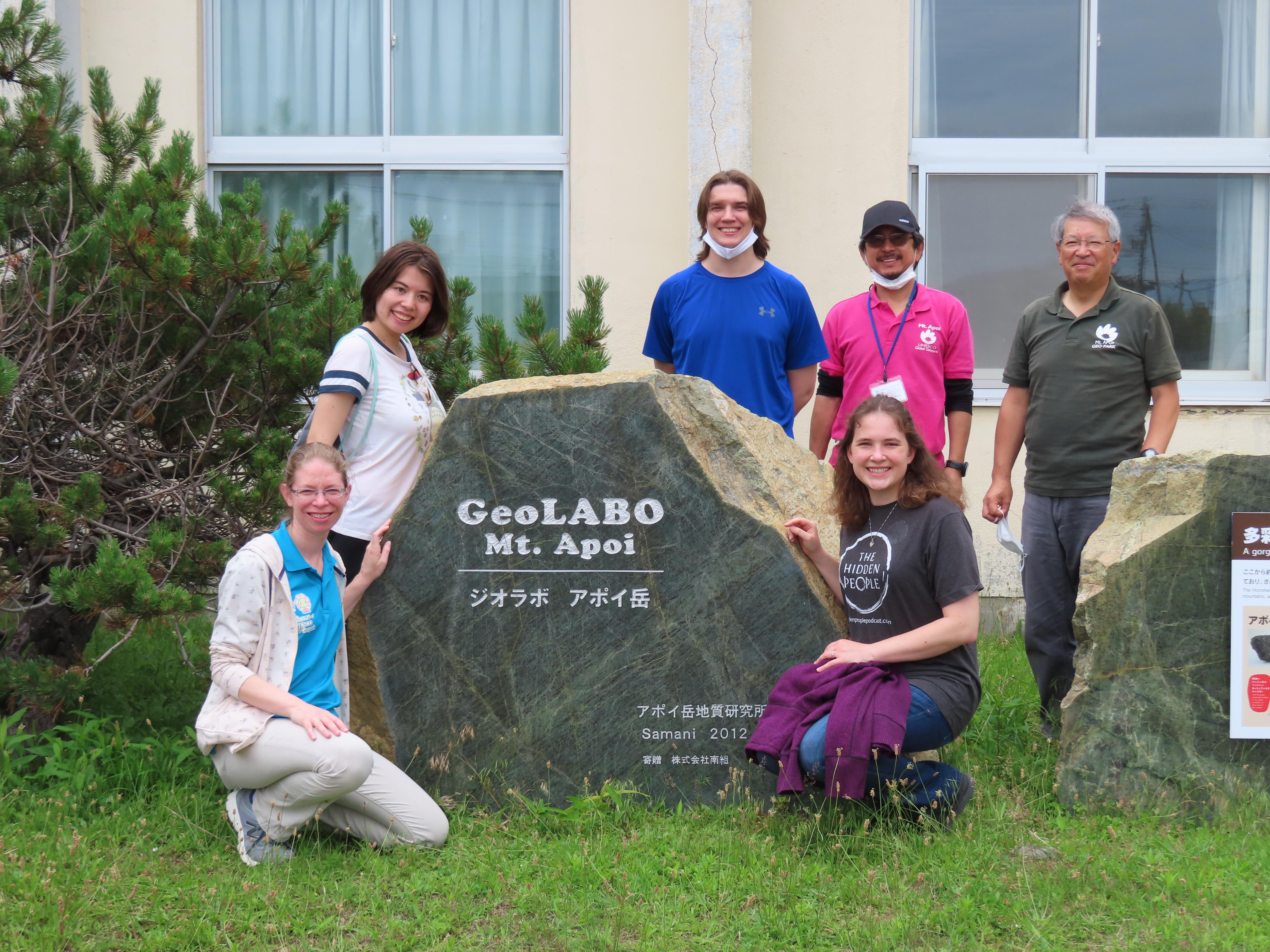 This time we decided to explored the Horoman Gorge. We met with the participants in front of GeoLabo Mt. Apoi. This tour was also kept to a small group of 3 ALTs, 2 guides, 1 interpreter, and 1 geopark staff. Luckily, we had decent weather this time around even though there was a small threat of rain that day. We introduced the guides for the day and then loaded up into a 12-passenger van to start our journey up the gorge.
Along the way to our first stop we saw the Toho Olivine Industrial Co. Ltd. that has an active quarry in the gorge. The rock and gravel that is mined here can be found all throughout Samani.
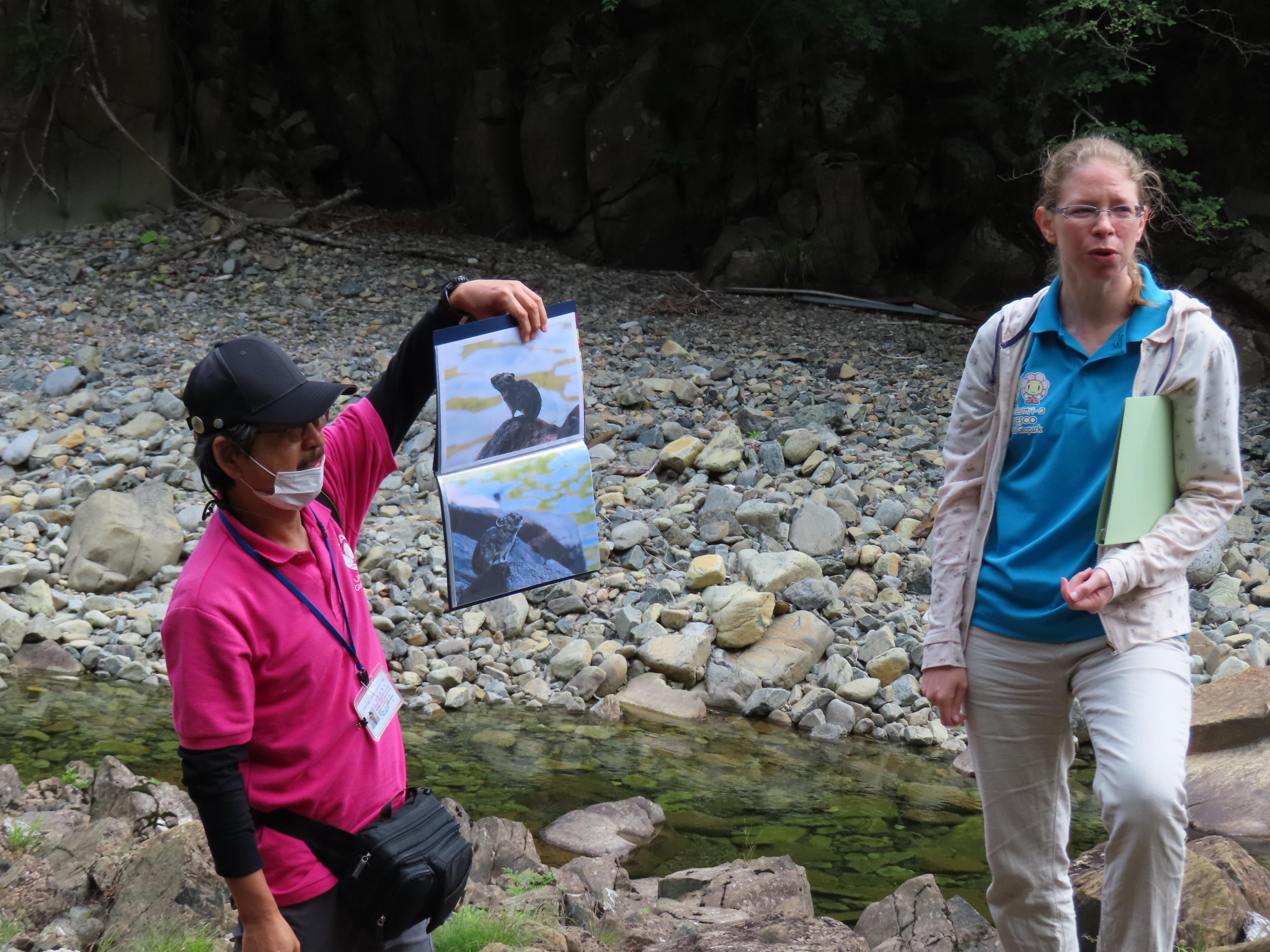
Our first stop was at Geosite A3, the Japanese White Pine Monument. The Japanese White Pine (or Goyomatsu in Japanese) are found throughout mainland Japan, but here they are at the northernmost boarder of their natural habitat. Because of this this pine forest has been recognized as a National Natural Monument by the Japanese government.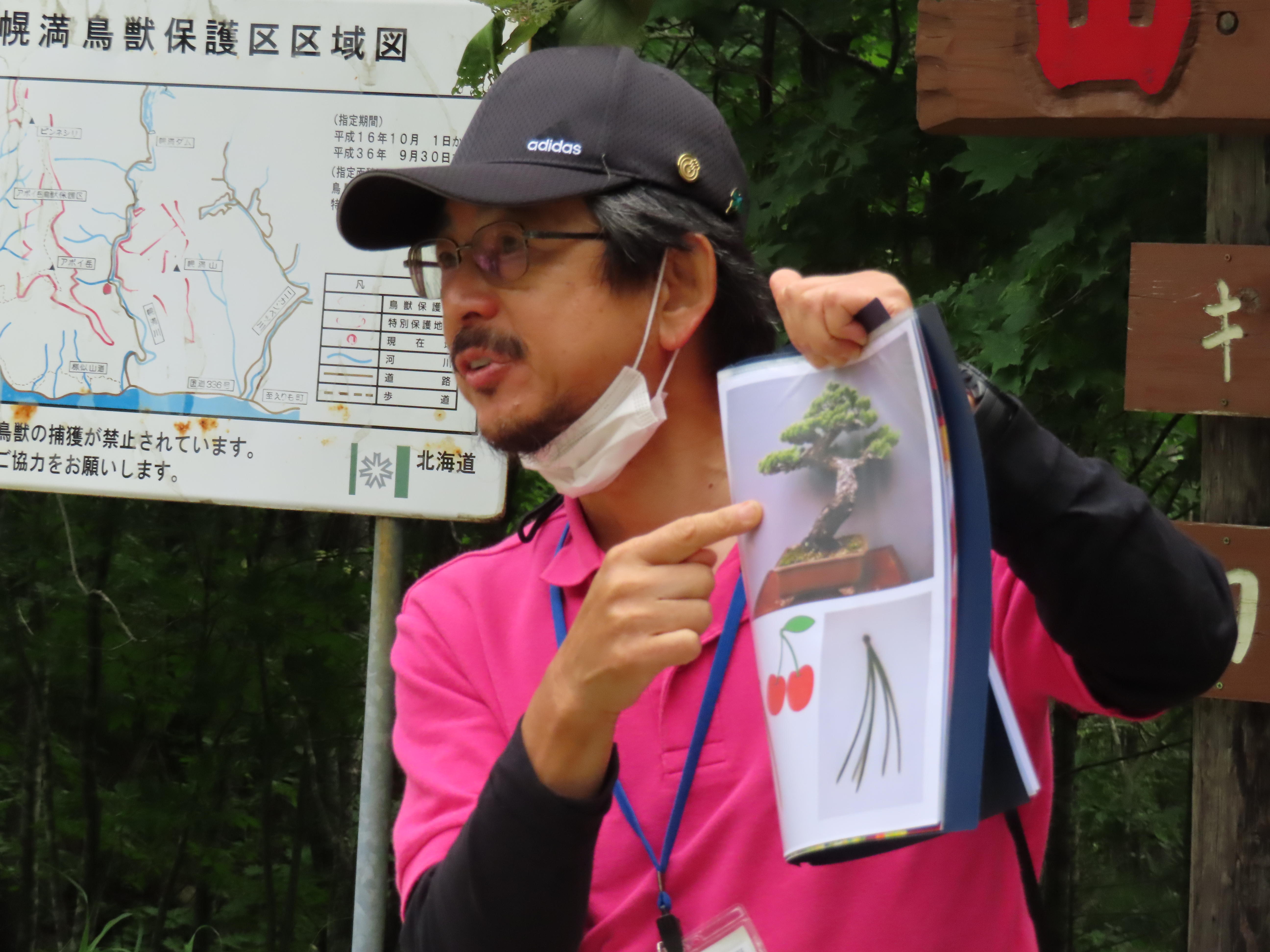 These pines are also different from other pine species since they have five needles per sheath verses other pines which typically have only two needles. The area around Geosite A3 is also home to the Japanese Pika. Pikas are typically found at high elevations of 150+ meters, however, this is the only place in the world where the pika can be seen at a mere 50-meter elevation. They are cautious creatures by nature, so unfortunately, we were unable to see one in person. Then we walked down to the river to learn about the Horoman Peridotite, its origins, and how peridotite is thought to be the mother of all rocks.
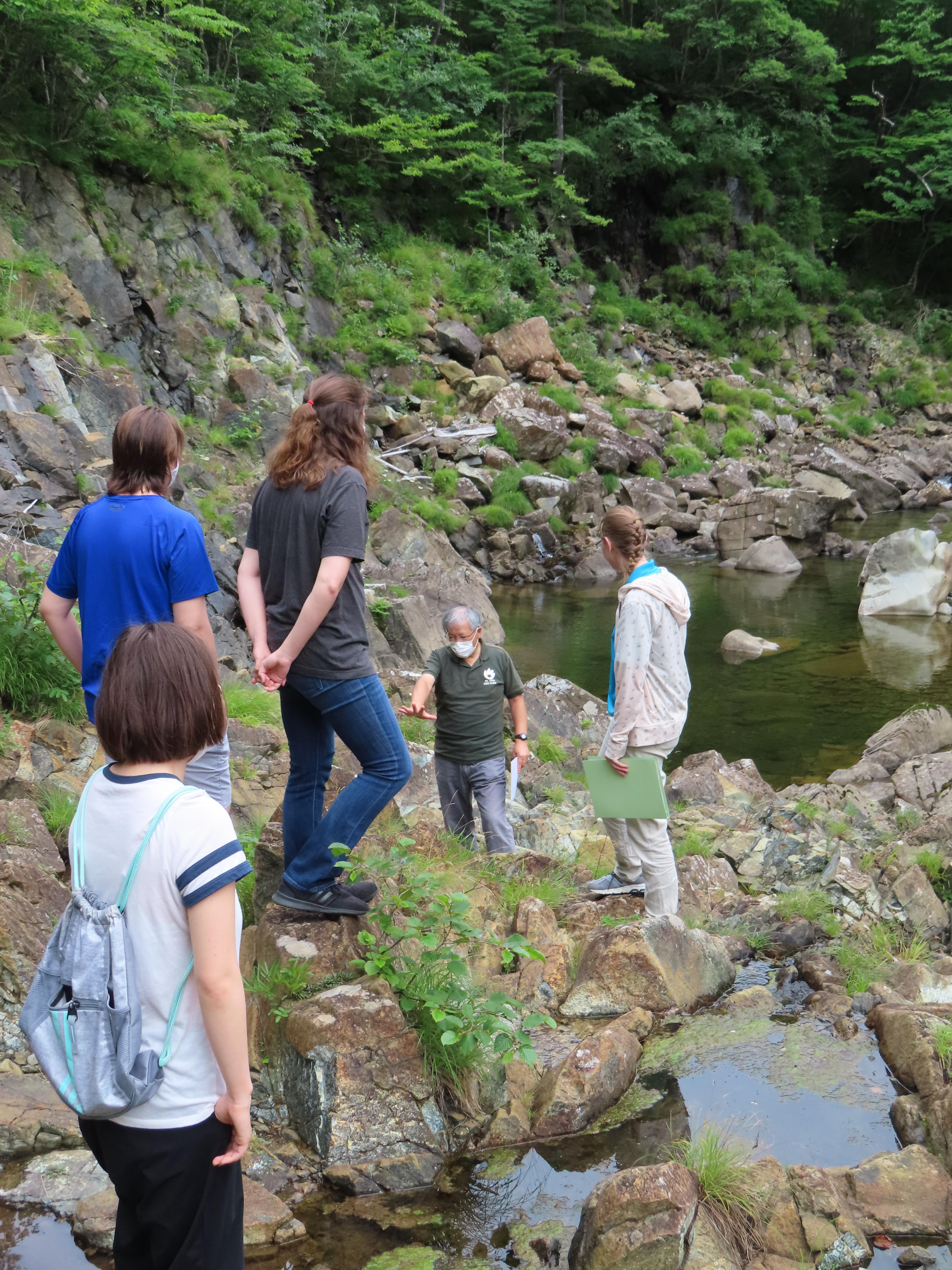
 Next, we stopped at the Horoman River Inari Shrine, Geosite A6. Here our guides explained a little bit about the history of Inari Shrines and why they are connected to foxes. In the past Japanese practiced Animism, which is the idea that gods reside in plants, animals, and inanimate objects. During the rise of rice farming in Japan, foxes became highly valued since they kept away rodents that would eat the rice. Hence foxes became guardians of the gods and received a special spiritual status. It is said that the fox's favorite food is fried tofu called inari, which is why sushi rice served in tofu bags is called inari sushi in Japanese. One of the guides had prepared some inari sushi to share with the participants.
 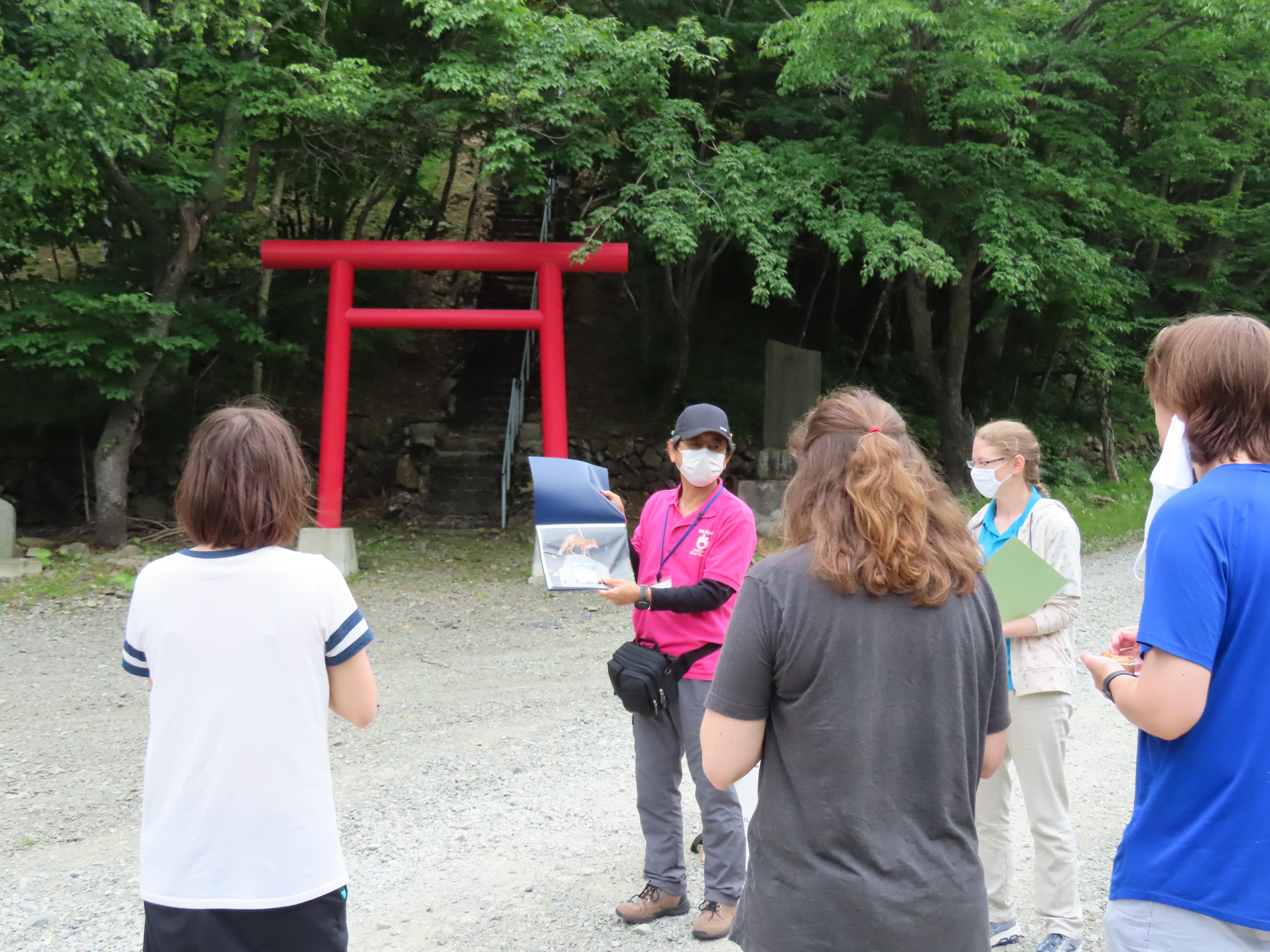 The Horoman River Inari Shrine was constructed in 1936 by Hidaka Electric, a hydroelectric power facility in the gorge that uses the river water to generate electricity for towns along the Hidaka coastline.
 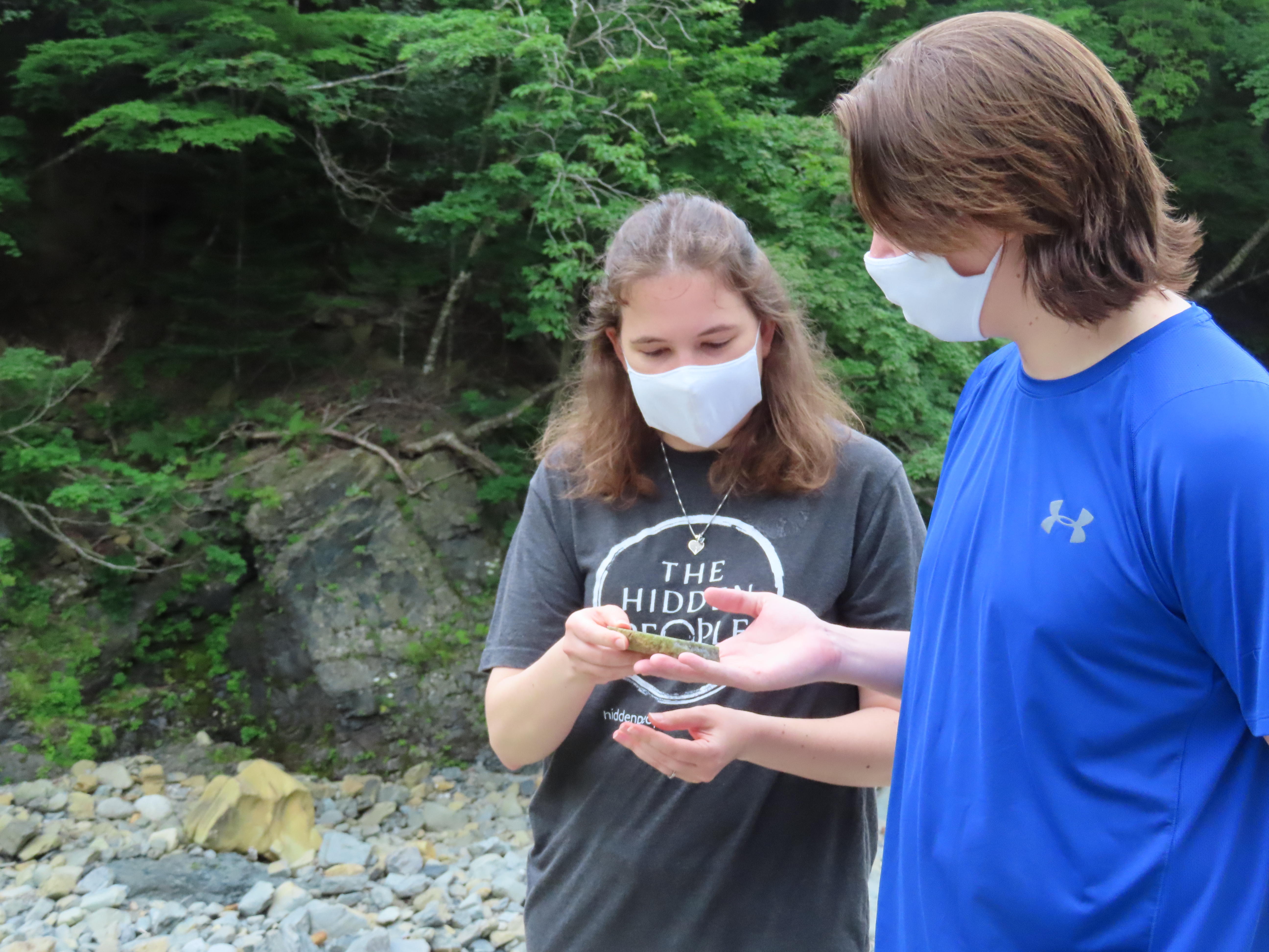 After Inari Shrine we hopped back in the van to visit Geosite A7, the Horoman Dam (Power Station No. 3). The Horoman Dam sits at the border of the Horoman Peridotite Complex, which is easy to understand as the landscape changes dramatically. On a clear day you can see the Hidaka Mountains. Unfortunately for us it was a bit overcast with clouds blocking the view, so we looked at a photo instead. Here the composition of the ground changes from the hard peridotite rock to softer gabbro and other metamorphic rocks.
 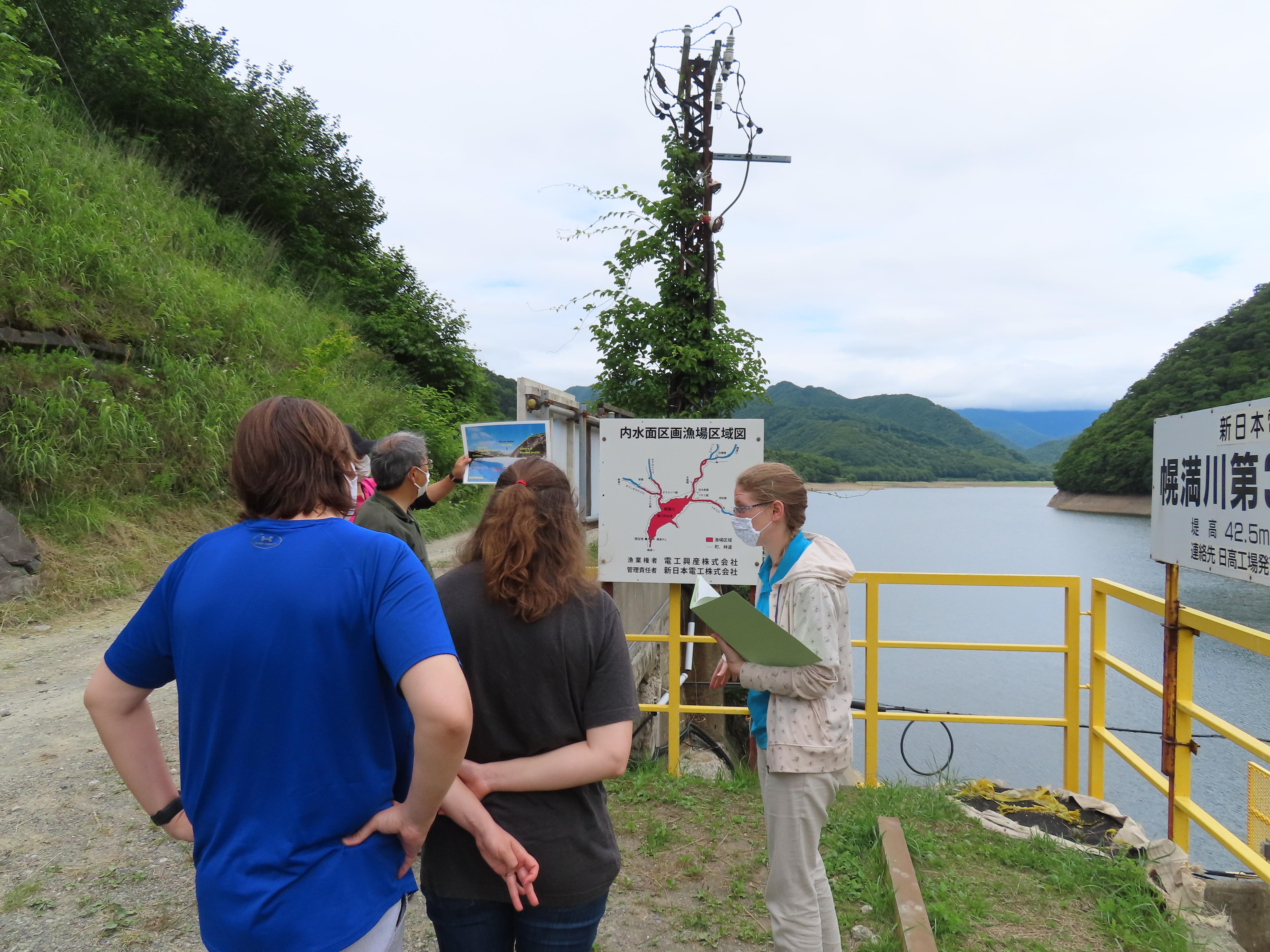 Our guide used a diagram of the rock stratus to explain that when the North American and Eurasian continental plates collided here to create the mountain range, the North American plate was pushed up which created a unique vertical stratification. Standing at the dam is like standing atop the upper mantle of the earth, and gazing out across the lake you can visualize how the different rock layers of the continental plate shaped the land millions of years ago.
It was easy to understand the guide's explanations since they also used photos and diagrams with English text.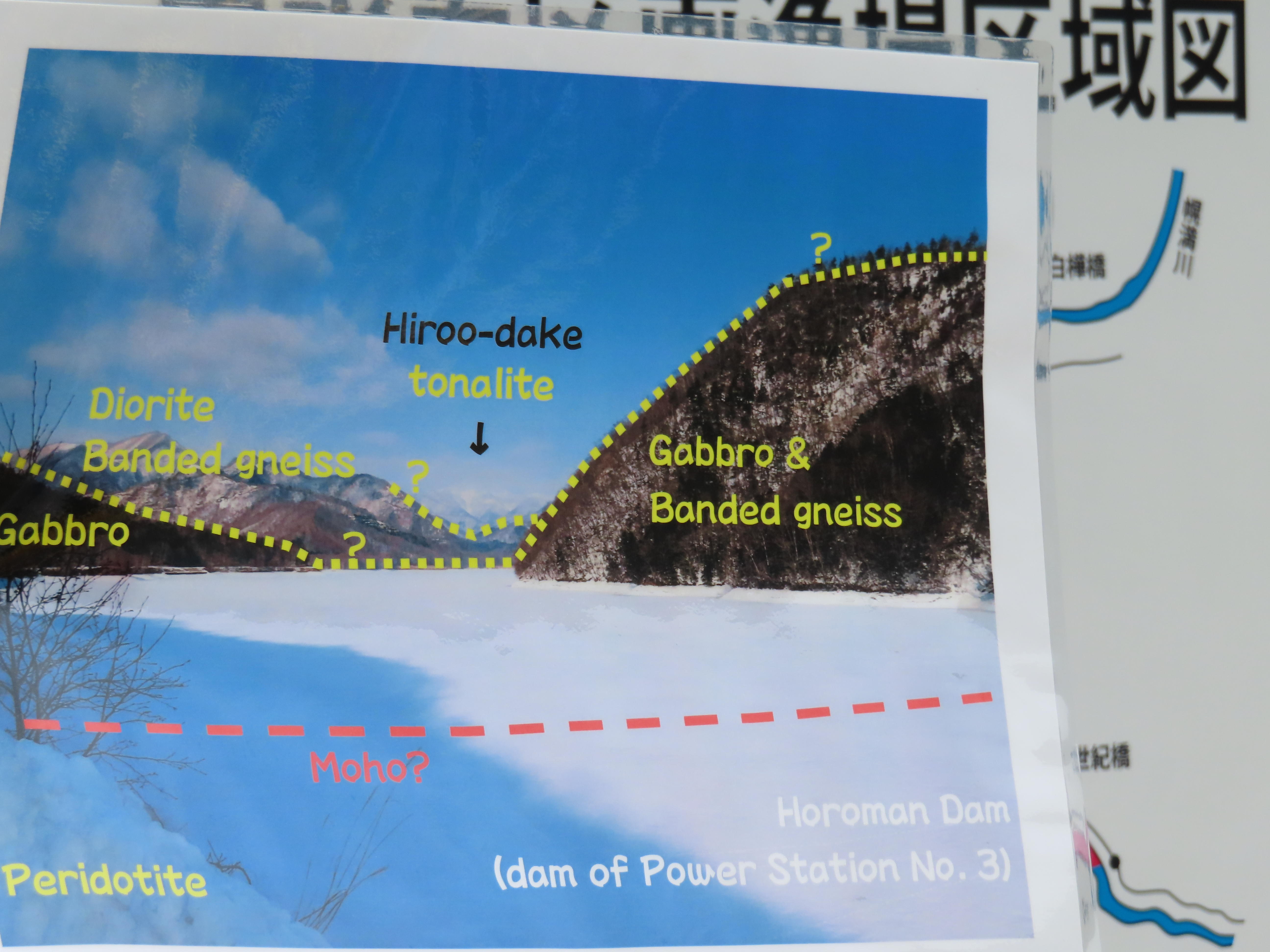
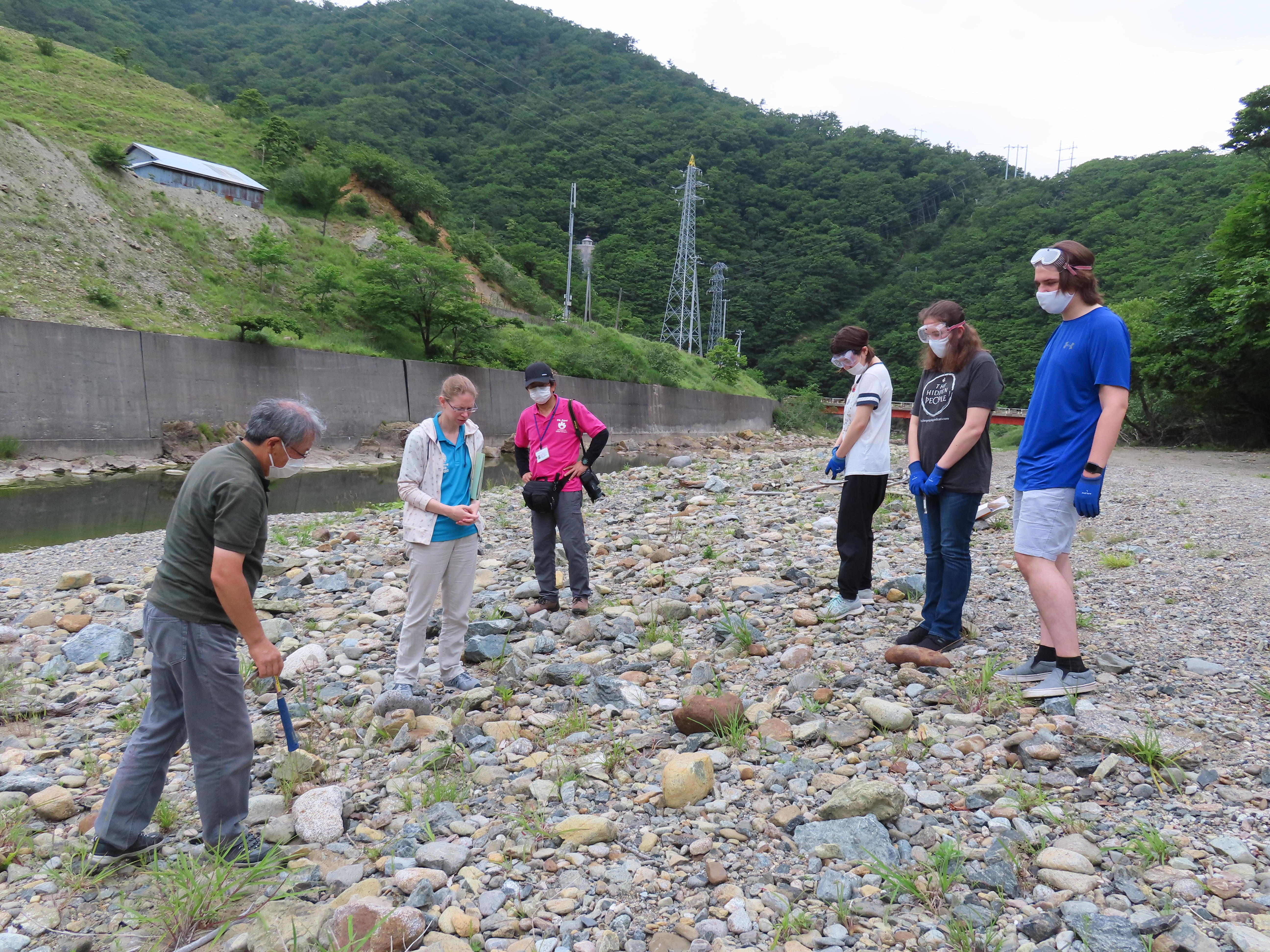
On our way back to the GeoLabo, we stopped at Geosite A2, the river bed near the quarry. Here the participants were given goggles, gloves, and hammers to try and crack open some of the river rocks to see what they could find. The weathered outside of the rocks is deceptive and the only way to see the beautiful mineral compositions is to break it open to see the inside. The participants had a lot of fun selecting just the right rock. In the end they found some beautiful specimens!